Where the River Goes Wild: The Missouri Breaks Interpretive Center
One More Door
By late afternoon we had done Fort Benton the thorough way: the dawn river walk, the veterans memorial, two centuries of history behind glass at the Museum of the Upper Missouri, the original blockhouse at the old fort, and then the tractors and bronze buffalo out at the agricultural museum. The sensible thing was to point the truck toward Great Falls, where the fifth wheel was waiting.
We did the sensible thing after one more stop. Because there was still one door we hadn't opened in town - and this one was flown under a different flag. Every museum we'd visited that day belonged to the town's heritage complex, that famous fifteen-dollar ticket. But the Missouri Breaks Interpretive Center, on the levee at 701 7th Street, is run by the Bureau of Land Management. Federal, not civic. And it isn't really about Fort Benton's past at all. It's about what happens to the Missouri after it leaves town - because downstream of Fort Benton, the river stops being a historic highway and becomes something rare: a wild one.
The Monument
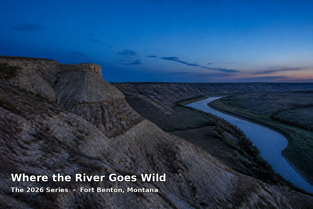
Here's the setup. The Upper Missouri River Breaks National Monument protects roughly 375,000 acres of central Montana - badlands, rock outcroppings, steep bluffs, and grassy plains wrapping around a 149-mile stretch of the Missouri that was protected as a National Wild and Scenic River back in 1977. The monument itself came much later - it was designated on January 17, 2001, in the final days of the Clinton administration, and it's managed by the BLM.
And the interpretive center in Fort Benton is its front porch. It's included in the town's heritage complex lineup, right along the levee walk where we'd started our day - but step inside and the subject changes completely. This is natural and cultural history of the wild river country: the geology of the Breaks, the wildlife that survives out there - bighorn sheep on the bluffs, elk in the breaks, the raptors riding the thermals - and the human story of the river when it still ran free.
The Part That's Still Lewis and Clark
We said this center felt like a coda to our whole day, and here's the direct link. About twenty miles downstream of Fort Benton, the Missouri forks - and in June 1805, the Lewis and Clark expedition camped at that confluence for the better part of a week, scouting both branches because nobody back east had any idea which was which. The northern branch ran toward what they hoped were the mountains' easy passes; the southern branch was the true Missouri, climbing toward the Great Falls we'd stood over the day before. Lewis named the northern branch the Marias, after his cousin, and the spot has been called Decision Point ever since.
They made the right call - the journals make clear how much it mattered. Wrong fork, and the expedition burns weeks it doesn't have. The Breaks country, and the interpretive center that introduces it, sits in the middle of that same geography: the landscape where Lewis and Clark's error bars were at their widest, and where the country itself got hard enough that the maps stopped helping.
And then there are the White Cliffs. Forty-odd river miles downstream, the Missouri runs through sandstone walls the expedition couldn't stop describing - Lewis wrote of rock formations like the ruins of ancient towers and ramparts, in colors he ran out of words for. That stretch is still more or less what he saw. No road follows it. The only way in is the river, or a long hike in from the byway. The center's exhibits walk you through that country - the formations, the wildlife, the river canyons - and by the time you come back out to the levee, the brown water sliding past Fort Benton looks different. You now know what it becomes.
A Different Kind of Museum
After three town museums stuffed with artifacts and steamboats and tractors, the Breaks center feels almost deliberately quiet. Fewer cases, more country. Its message isn't look what we collected; it's look what we didn't. Everything in the room points out the door and downstream, to a river you can still float for 149 miles without seeing a road crossing, through the same cliffs Lewis mapped and the same breaks where the bighorn still stand.
That's the right note to end a day of history on, actually. Because the whole day had been about what this river built - the town, the fort, the trade, the farms. The Breaks center is about what the river kept. It's the one museum in town where the collection is outside, and it's running.
If You Go
The Upper Missouri River Breaks Interpretive Center is at 701 7th Street, Fort Benton - on the levee walk, a short stroll from the other museums and the bridge. From Great Falls it's about 40 minutes up US-87. It's part of the Fort Benton Museums and Heritage Complex, so the town's combined ticket covers it alongside the other museums; check current hours before you go, as federal-run centers keep their own schedule. Canoeists take note: this is also where you arrange the famous multi-day floats down the Wild and Scenic stretch - Fort Benton is the classic launch point, and the center is where you get the current conditions and the lay of the land before you commit to the current.
For us it was the last door of the day. We'd started at dawn on this same levee, and we closed it out twelve hours later reading about the country the river was headed toward. Then we drove the forty minutes back to Great Falls with the evening coming on, the fifth wheel waiting, and Fort Benton logged as one of the best single days of the entire trip.
Last Light
Every river town is a frame around moving water, and Fort Benton has more frames than most - a fort, a levee, three museums' worth of story. But the Breaks center reminds you of the one frame that matters most: the river doesn't belong to the town. The town belongs to the river. And downstream, past the last bridge, the river goes back to being exactly what Lewis and Clark found - wild, quiet, and utterly uninterested in being explained.
Go to Fort Benton for the museums. Stay for the door they all point to.